by Jocelyn Bertheau
“There’s a small watercraft warning and a thunderstorm coming up later in the day … the local kayak outfitter is not renting!” we heard from the ranger at the new visitor centre of Fathom Five National Marine Park, just outside Tobermory.
A couple of months earlier Frederik Beelaerts and I had started planning the crossing from Tobermory to Killarney by sea kayak, a 125-kilometre trip that we would do in three to four days. Having done the crossing to South Baymouth on Manitoulin Island a couple of times already (and returned by way of the Chi-Cheemaun car ferry) I was somewhat familiar with what to expect. So I was a tad concerned by the warning we received, all the more so since the area is full of wrecks from less fortunate sailors.
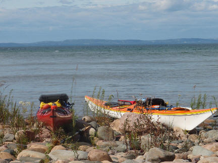
But all was just quiet down at Dunks Bay on a beautiful Saturday afternoon in mid-July. “Wow, that’s cold water!” was one of my first comments. I knew it would be colder than on Georgian Bay’s eastern shoreline, but in mid-July, who would expect arctic waters in southern Ontario?
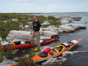
So we launched after goodbye kisses to my wife and daughter, who would do the trip by car, via Manitoulin and Sudbury, to meet us again at the end of our journey. At the tip of the bay it did blow a bit with some choppy waters – a good reason to put on a wetsuit. But the 4-kilometre crossing to Flowerpot Island, via a small unnamed island halfway, was not too bad. Once we got on the lee side of the island, the crystal clear turquoise waters reminded us of the Caribbean again.
On the north side of the island, past the famous flowerpots, the water and weather looked more daunting. We decided to do a hike instead, visiting the cave and the lighthouse, with lots of other day trippers. As soon as we landed, a big snake was there to welcome us, and he was not scared at all!
Also, a ranger came, wondering if we were the guys going to Killarney, could we give her our precise itinerary and please call them when we arrive: our tax dollars at work. The storm did hit us so it became clear that we would end up spending the night on one of the wooden platforms set up for tents. An early dinner meant hitting the sack before nightfall.
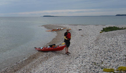
Awake at 5 a.m., on the water at 5:30 and red sky in the morning … Snake Island was clearly in view just north of Flowerpot with only a few whitecaps here and there in between. As we paddled along, the wind picked up a bit and the clouds became darker, but we were in our element. Instead of snakes we were greeted by all sorts of birds (seagulls, pipers, geese, cormorants and even a heron family). Actually we were not very welcome at all, as the gulls especially were dive-bombing us now and then.
We nevertheless stopped for a warm breakfast and walked around half the tiny island, enough time for the good weather to appear on the horizon and the wind to ease down a bit. This gave us the necessary confidence to decide to move on to the next objective: White Shingle, just a low pebble beach in the middle of the big water. Nothing there to do, so we continued on for THE open water crossing of the trip, just over 8 kilometres.
There we were, alone, going mainly against the wind through some big swells, nobody around except for a very distant sail boat and an equally distant Chi-Cheemaun: an exhilarating experience! Although we were wearing wetsuits, we did not want to capsize and rely on self-rescue techniques to survive. Our boats remained pretty stable and about two hours later we landed on Lucas Island, at a sheltered little cove; time for lunch and a snooze.
Next was the short crossing to Yeo Island and on to the largest island in the area, Fitzwilliam Island. Our direction had been northwest the whole morning; then later we were heading due north along rocky, narrow beaches, past McCarthy Point and Pavement Point, all the way to the island’s northern tip, in very calm water.
A late afternoon crossing in choppier water brought us to our destination of the day, Wall Island, with a wonderful flat ledge for our tent and no bugs thanks to the constant breeze. In over 13 hours we had paddled nearly 40 kilometres with not a soul in sight, just us and the wild, raw nature of Georgian Bay.
We were again on the water at 5:30 a.m. the next day for a calm, 6-kilometre crossing to Manitoulin Island. The whole Wikwemikong peninsula is unceded native land, and apart from seeing a few dwellings here and there, we never saw anybody on shore that day, or on the water for that matter. Protected from the rough westerly winds we had a very smooth paddling, except for a couple of large, windy bays we had to pass (e.g. James Bay). Most of the day we even had a nice breeze at our backs.
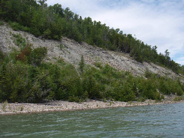
To the east we saw Rabbit Island and Club Island and in the far distance Lonely Island, likely destinations for sailing yachts. A couple of deer on the shore were wondering who or what we were. Towards the end of the day, as the weather started to look threatening, we passed the impressive 200-foot high Clay Cliffs (i.e. not rock), and reached Cape Smith on the northern tip of the peninsula.
As a fierce wind was blowing out of the large Smith Bay, we were forced to set up camp right there (illegally, because you’re not supposed to camp overnight on native land without permission from the local band office). Another day at the office with 38 kilometres of paddling.
Because of the bad bugs in the early morning it only took us 20 minutes on day 4 to fold camp and push off; at 5:30, with the sun rising to our back, we were heading into the now totally calm bay to cross it a bit further down to Nadeau Point, on the other shore. Through some pretty channels with tall grass we reached the Burnt Islands group and the majestic La Cloche range of Killarney came clearly into view.
But the wind was blowing again and the whitecaps of the North Channel were intimidating. After some lunch for energy, we decided to go for it and cross over to Centre Island, at the end of one of the Killarney land tongues. Heading straight into the waves created some excitement now and then as water splashed over our spray skirts.
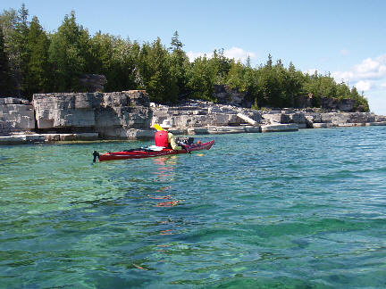
Once on the other side I was amazed by how much warmer the water temperature was, at least 5-6 degrees higher – much better for swimming. The rocks (Canadian Shield and quartzite, rather than the limestone-like dolostone of the Niagara Escarpment) and the vegetation (mostly fir trees in comparison to the deciduous trees earlier on the trip) made for dramatic changes in scenery.
We went a bit farther north into Frazer Bay via a narrow channel called Hole in the Wall. The wind had picked up even more and we had a heck of a time surfing the tumultuous waves all along the rocky south shore. This was great exercise for us to keep our kayaks in balance, while in the relative safety of being close to shore and not in ice-cold water. A bald eagle was soaring above us, just as happy with the gusty winds.
It only took us a couple of hours to cover the last 10 kilometres to Rat Portage, which led us back into Killarney Bay. Just south of the cove was a wonderful little private beach for us to spend the last night. The next morning was an easy one-hour crossing to Killarney town, passing by huge motor cruisers, many from the USA.
There we rendezvoused with my wife and daughter for the trip back home, but not before buying fresh lake trout and white fish from the well-known Herbert Fisheries and seeing two cubs and a mother bear on the side of the road just outside town.