or Saunas, Safe Havens and other Beautiful Places of the Superior North Shore
by Mary Jo Cullen
Missing out on the glorious mild weather of last May, it wasn’t until the end of the first week in June that I finally was ready to launch my baidarka into the clear, cold waters of Lake Superior at the beach in Silver Islet, a charming village on the tip of the Sibley Peninsula. I was setting out to complete a solo, 1200-mile kayak trip around Lake Superior, begun the previous August from the mouth of the Michipicoten River. The boat, an Aleutian kayak with a pine and oak frame lashed together with jute then covered with canvas, had been built in a workshop at Naturally Superior Adventures in Wawa in the spring of 1997. The Superior trip was its maiden voyage and it had stood up well on the approximately 1,000 miles covered that summer and fall. At the end of the season few repairs were necessary. A cracked rib had to be splined, and a number of lashings replaced.
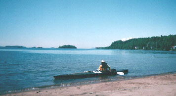
Levering myself into the snug cockpit sized for my exact dimensions, and pushing off from shore, I felt that familiar shiver of anticipation. For me, much of the appeal of kayaking comes from that sensation of floating, weightless as a leaf, on the surface of moving water. In a baidarka this feeling is somewhat accentuated because the keel is actually made from three pieces of wood lashed together. These pieces each move slightly, and the boat flexes as if it had a life of its own. What a delight to be kayaking in it once again on this magnificent lake, with the whole of the spectacular north shore to explore.
A four-mile crossing of Middlebrun and Montreal channels to Edward Island, led to the first camp at Horsehoe Cove. Although this made for a short first day, it was a spot in which I wanted to spend a little extra time. On a previous trip with my husband in 1991, we had passed up Horsehoe Cove in order to get in a bit of distance on our first day out. I wasn’t going to miss this charming little spot a second time. Quite protected, it is a popular harbour for sailboaters, and I was pleased to have it all to myself, to be able to watch for wild life and listen to birdcalls. I made camp close to the hidden pool or “hook” formed by one arm of the cove, found an excellent spot to hang the food, then went for a very quick dip.
Despite the chilling water, the sun was warm and I dried quickly. A family of otters came to check me out, decided I was no threat, then put on a fascinating display of aquatic maneuvering in the clear turquoise water of the pool. As the light waned, tall spruces were mirrored in the calm water. I cooked a hot supper on the camp stove, and drank cups of tea, watching till it was completely dark.
In the morning northeasterlies had moved in and as I paddled up Walker’s Channel to Magnet Island there was a cold headwind. I was looking for a particular island in a small, heavily treed archipelago with deep fjord-like winding channels, just off the south east shore of Black Bay Peninsula. Rounding Magnet Island, I had been told, you head northeast to the square, white tower of No.10 light, then take a reading on Swede Island. It’s a five-mile crossing.
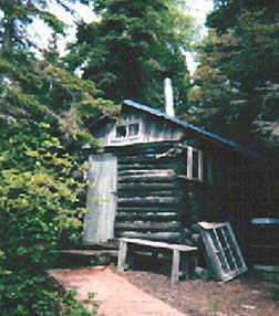
Paddling north along the east shore of Swede Island in the gathering darkness and beginning to feel the increasing night chill, I happily imagined the warm camp that awaited me. For on the wilderness of Swede Island, tucked into a bay known locally as Whiskey Cove, there is a cabin with a sauna. The cabin has been rebuilt, but the sauna is the original, going back, apparently, to the forties or earlier. The site, on crown land, exists as a safe haven for fishermen and boaters caught in Lake Superior storms or rough seas. It is one of several along the north shore, and is maintained, gratefully, by those who use it. The sauna is there for all.
I had first discovered this network of safe havens last October when seeking shelter from rough weather at Hole in the Wall, by the Pigeon River in northern Minnesota. And before packing it in for the season, ran across a number of other sites. Just north of the Canadian border there is a line of rugged islands that in an earlier geological age, were apparently part of the mainland. These islands are essentially high rocky cliffs covered with balsam and spruce, but here and there along their periphery are sheltered indentations with sand or gravel beaches. In one of these bays, on the north side of Spar Island there is a cabin and a sauna also built on crown land. This spot merits a visit simply for the network of hiking trails that radiates from it, particularly the lovely Top of the World trail that leads to a splendid view of the coast. And on the south side of Thompson Island, about a kilometre from the northeast tip, there is a beautiful deep bay with a wonderful sauna that, in an emergency, could also be used as a shelter. I was told that there was a sauna on nearby Flatland Island as well and would have liked to check it out. I had become fascinated by these sites which were turning up in particularly rugged and beautiful parts of the lake.
The shelters themselves are generally charming little cabins, delightful to visit or to spend a few days in if necessary. They usually come complete with wood stove, dishes, cutlery, candles, lamps, axe – anything a person would need to survive a spell of bad weather. And there are often saunas in addition to the cabins, presumably because, to a large extent, the original settlers all around the north shore were Scandinavian. And they wanted their sauna. (Pronounced “sow-na”, everyone insisted!) Which turned out to be such a welcome tradition on this cold lake that it became inconceivable to build a cabin without one. Solitary saunas were even built here and there along the shore in sheltered places, for use by anyone passing by.
In the sauna at Whiskey Cove the heat felt wonderful. My tired old bones soaked it up. When I finally headed for the tent, clean, warm and deliciously sleepy, it was after midnight. And next morning, knowing a good thing when I found it, I hopped over to Spain Island, and to Bahia Espana, a tiny sauna hidden among the tall spruce. You had to know it was there. I set the tent up intending to use this lovely spot as a base to explore the surrounding islands. Just as well. Strong winds and thunderstorms moved in suddenly and hung around for several days. It was good in the evening to have a dry shelter to retreat to. Good to light the coal oil lamps, and the stove, to take a sauna or wash clothes which, hung up overnight in the heat, would be dry in the morning.
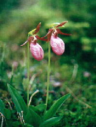
On one short excursion I paddled in the early evening to Loon Harbour through the narrow, winding passage that separates Spain from Borden Island. It was enchanting. A lovely channel full of reflections so clear that it was hard to tell what was real. At the end of the passage, as beautiful Loon Harbour opened up, Spain Island curved away to the north, a vast sheet of sloping, glacier smooth rock, like a great amphitheatre. While exploring the upper slopes, I found deep beds of green moss in which patches of lady’s slipper added soft tones of pink and mauve. Dead spruces nearby stood completely covered in the delicate green hanging lichen of old man’s beard, as if clothed in magnificent funeral gowns.
Leaving this beautiful area with reluctance, I paddled northeast along the wild shore of Black Bay Peninsula. Roche Debout Channel lay calm and serene in the morning light, as I headed across. About half way over white caps appeared up ahead and seemingly out of nowhere came a fierce wind. Sprinting across the remaining mile, I had an experience of deja vue. My husband and I had raced across this channel in 1991 before an approaching thunderstorm. At that time we had sought shelter in a tiny cove off Dawson Bay, and I headed for it now. Remembering that you couldn’t see the cove until you were almost upon it, I cut across to the far side of Dawson Bay, trying to avoid rocks and breaking waves. Then, suddenly, there it was, an opening tucked in behind a high point, barely wide enough for two kayaks. How good it felt to enter calm water, to land the kayak safely on the pebble beach and to step out onto dry land.
I made tea and hot soup then hiked over to the beach at the mouth of Dawson Creek. It’s an interesting spot to explore. On old beaches extending inland, are the remains of what was apparently an extensive logging operation. Huge steel belts lie rusting on the gravel. In 199l several old buildings were still standing, almost hidden amongst the trees and brush that had grown up over the years. They appeared to have been living quarters and perhaps stables for horses. I was disappointed not to find them on this trip. We had been fascinated by this place and the images it evoked of great draft horses, breath steaming in the crisp winter air, hauling logs onto the frozen bay. Later we had enquired about it at the Information Centre in Terrace Bay. They had no record of it but said that it would have been abandoned by the thirties when logging along this coast ended.
Discovering some fresh bear droppings and a flattening in the grasses where the animal appeared to have been bedded down, I discretely withdrew to the kayak. When the wind dropped later in the afternoon, I loaded up and headed for the rugged high rising islands of Fluor, St. Ignace and Simpson. I was very much looking forward to seeing them again.
At Fluor my husband and I had paddled in the fog through the narrow passage that cuts off a portion of the island. Spruce trees leaning out over the banks, had appeared and disappeared in the swirls of fog. We could hear the whirring of unseen ducks taking off, and the hoarse squawking of herons startled by the silently drifting kayaks. Once back on the lake, my husband had navigated in dense fog across Blind Channel (rather an appropriate name, we thought at the time) to Agate Island and then finally on to Paradise Island.
Paradise was intriguing. Formed entirely of layers of pink gravel covered with lichen and moss. Wonderful for hiking over. Old gravel beaches encircled the periphery – I counted about twenty-five of them – all overgrown with moss on which small shrubs had grown up. We stayed an extra day to explore and to play around in empty kayaks, bracing into the waves. The island was well worth a visit. But because of this side trip we had by-passed the CPR Slit, one of the most fascinating and beautiful spots on St. Ignace Island. Never having heard of it, we weren’t on the look out and didn’t know what we had missed. I found out about it on this trip when talking to people about safe havens.
After crossing Blind Channel, from Fluor over to St. Ignace, a short one-mile paddle along a rock and shoal strewn shore leads to the “hook” of Squaw Harbour, otherwise known as “the CPR Slit”. Here a spectacular pink gravel spit extends a considerable distance into the lake, then does an approximately 135 degree turn and heads back to land, creating a wide basin (or “slit”) between two lengths of gravel and leaving an opening for boats with shallow draft. Perfect for kayaks.
Approaching this remarkable geographic phenomenon, you are struck by its size, and by the fact that it obviously has not been formed by a river, the way the other large spits encountered along the Superior coast have. Where, then, did all this gravel come from? Was it deposited by a glacier? Formed by the break-up of softer rock overlying bedrock? Rooted in the gravel are spruce and fir, hung with old man’s beard, that screen the harbour itself from view. Proceeding along the edge of the spit it is not until the final rounding that you discover the beautiful lagoon hidden inside.
Although one could not help but wish that this magnificent site were still in its natural state, there have been buildings here since around 1927 when the CPR built a few fishing cabins for wealthy guests staying at their lodge in Nipigon. Currently there are docks, a safe haven, and a sauna, all of which have recently been rebuilt by an enthusiastic group of boaters. These folks also maintain local trails, including one to a mountain outlook, with, on a clear day, a great view of the gravel shoals amidst the turquoise water and pink gravel banks.
Early one evening I crossed over to Simpson Island heading for a highly recommended campsite in Woodbine Harbour. This harbour is enclosed by cliffs covered with spruce and fir trees which, in the setting sun, first took on a brilliant glow, then reproduced identical copies of themselves in the still water. I paddled carefully, trying not to disturb the magic.
The campsite was perfect. A smooth ledge, sloping at just the right angle to land the kayak, an ideal tent site by a stash of dry wood, and trails up to the cliffs for look outs. Even a privy in the bush. Campsites like this produce such a sense of well being. Cooking supper on the stove, by the light of a headlamp, I was awfully tempted to make a campfire. Not to cook by, but for the pleasure of watching the flames, and to have a reason to extend the pleasure of the evening. There was no wind and it would have been lovely. But on paddling into the harbour I had smelled smoke. Somewhere a forest was burning. Everything was so dry. Better not to take a chance.
Tomorrow I would be paddling into Rossport to the last sauna stop in this section of the lake. The Rossport Inn is frequently a stopover point for kayakers passing through on long trips, as Ned Basher, the owner, is a kayaker himself and always ready to be of service. Ned, happily, has a sauna at the Inn.
Although there are safe havens farther east along the lake, they are relatively rare. There are a number in the Slate Islands, at least one of which, apparently, has a sauna. And farther east in Pukaskwa National Park, the former lighthouse keeper’s home on Otter Island is left open for anyone in need.
But there would be many beautiful places to visit over the next few weeks. The harmony of rock and sand at Neys Provincial Park. The magnificent cliffs of Pic Island. The haunting beach and vast dune area at the mouth of the Pic River. And of course, the pristine splendor of Pukaskwa. That I could see it all by kayak, and at my leisure, was a blessing beyond measure.
