

by Nancy Morgan
Patti Cupit, an enthusiastic kayaker and tripper, initiated the idea to kayak the Saguenay in the summer of 2013. Through her exploration of several websites, she identified the Aventure Ecotourism Quebec website, and an independent guide to lead an eight-day trip from La Baie to Tadoussac. Patti’s contact suggested the length of the trip, and the timing which was the last week of July. We provided all the food and our own equipment with the exception of a double kayak for the group, a necessary safety precaution for a long trip in an isolated area. We met at Auberge des Battures at 8:30 a.m. on July 25th for an information sharing session, and discussed our concerns and expectations.
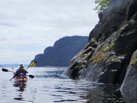
Radeau was the defining term for the start of each day; a group meeting on the water to ensure that we stayed together and understood the plan for the day. La Baie, our entry point, is situated at the end of the fjord about 130 kilometres from Tadoussac. The tides at this point are about 6 metres, which causes intertidal mudflats or battures. The tide was completely out, so we had the morning to load kayaks, and decide on how much water to take with us since there are few places on the Saguenay to pump water. Depending on the tides, campsites on the fjord can be difficult to approach. Campsites on the South side of the Saguenay were selected, since these can be more accessible.
Several places we visited on the fjord were highlights. The site of “La Nouvelle France” included a Huron village and a Cent-associés farm. As well, the village of Sainte-Rose-du-Nord, the discovery and visitors Centre in the Baie Eternite sector and the Beluga Discovery and Visitors Centre on Baie-Ste-Marguerite enhanced our experience. On day six, we arrived on the sand beach at Village Vacances de Petit Saguenay, a campground with multiple facilities including a pickup service at the shore. We were driven to our waterview campsites overlooking the Saguenay. The showers, washrooms, laundromat and buffet breakfast were all appreciated by the group. This campground is perfectly situated for accessing Baie-Ste-Marguerite to watch Belugas feeding and playing in the Bay.
Encounters with wildlife were the most memorable part of the trip: moose visited our campsite, seals basked on rocks and swam ahead of the kayaks, 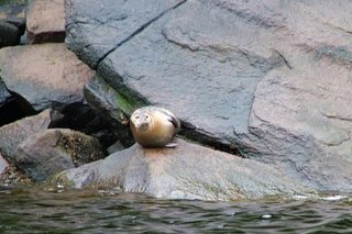 peregrine falcons played in the treetops, and salmon swam in rivers. Another high point was being surrounded by about 20 Beluga whales in Baie-Ste-Marguerite. These whales swam past the kayaks and interacted with the paddlers. A minke whale feeding along the shoreline was spotted, and we watched at a distance. On our last night, with calm waters, and a million stars overhead, we paddled at midnight, amongst the sleeping Belugas near our campsite. Awesome!
The challenges of tides, currents, days of paddling, and setting up camp were offset by good humour and amazing group meals. Our first dinner, served by Peter, was a fresh stew served with generous amounts of wine. Phil’s breakfast of an omelet in a zip lock was a big hit, as were, Susan’s pancakes with maple syrup, and Nancy’s risotto with sausage and mushroom. Gerry prepared an amazing tiramisu, followed the next night by Patti’s vanilla pudding with cherry sauce. The trip came to a close with a demanding paddle into Tadoussac, topped by a celebratory lunch and local beer on the patio at Cafe Boheme. A fitting end to a great experience!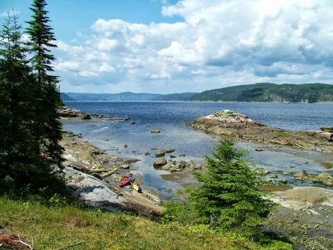
GPS settings La Baie to Tadoussac:
Site de kayak-camping de l’Anse à Didier: 48° 21' 16.8'' N 70° 37' 14.4'' W
Site de kayak-camping de l’Anse du Gros-Ruisseau: 48° 20' 31.8'' N 70° 25' 22.5'' W
Site de kayak-camping Le Delta: 48° 17' 48.5'' N 70° 19' 34.5'' W
Site de kayak-camping de l’Anse de Tabatière: 48° 16' 01.8'' N 70° 12' 05.1'' W
Site de kayak-camping de l’Anse à Tidée: 48° 14' 28.2'' N 70° 01' 35.7'' W
Village Vacance Petit Sagueany: 48° 12' 34.4'' N 69° 54' 12.1'' W
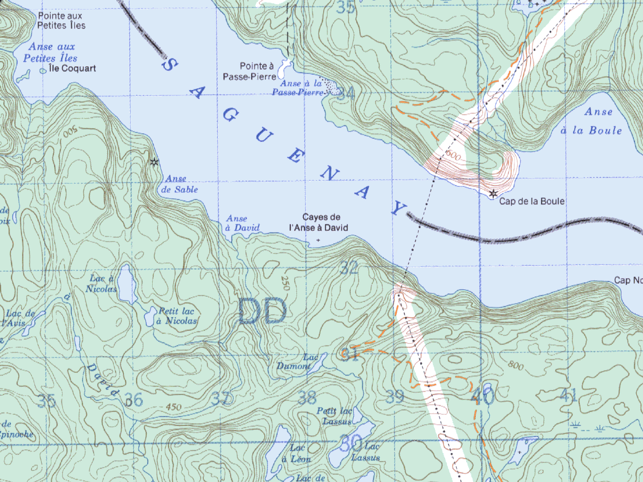
Site de kayak-camping de l’Anse à David : 48° 08' 34.6'' N 69° 50' 39.5'' W
Links
Parc national du Fjord-du-Saguenay
Maps
- CanMatrix – Print Ready – 022C04 – Tadoussac, Quebec
- CanMatrix – Print Ready – 022D08 – Cap Éternité, Quebec
- CanMatrix – Print Ready – 022D01 – l’Anse-Saint-Jean, Quebec
Charts
- Chart 1202 – Cap Éternité à/to Saint Fulgence
- Chart 1203 – Tadoussac à/to Cap Éternité