
by Melissa Hachkowski
Everyone who has kayaked, backpacked or tripped solo for any length of time has developed a list of top secret spots: places which bear personal significance, aura and importance. These are the places we return to many times and still have the ability to find something new that we didn’t recognize before. These are places of comfort, a home where other human visitors are rare and four legged and two winged visitors are more frequent. These are places we try to keep for ourselves, because if we ever landed at such a spot and discovered that someone else was already there, it would simply be devastating. We would have to share! We work hard to find these spots, exploring countless numbers of creeks, rivers, canyons and coastlines. Hopefully you can understand then that I will not give specific details of the “good spots” on this trip. These spots belong to the trip participants: Sarka, Jim and me. On very rare occasions, I am privileged to paddle with people who have similar curiosity, energy and enthusiasm as I in terms of outdoor explorations. This happened on this trip; and combined with Lake Superior’s display of sheer strength and power, made this an unforgettable trip.
We departed from Superior Outfitters’ dock in Rossport and soon encountered one to one and half metre waves blowing in from Nipigon Bay. Expecting conditions to be just as strong on the open lake, I opted for a sheltered channel route behind Wilson Island to Copper Island for the first night. We found a beautiful cobble beach, complete with a large stack of wave-pounded ancient boom logs washed high into the ledges of a raised cobble beach. Our campsite was second to none. Our kitchen had a set of terraced ledges carved into a rock wall, which descended into an amphitheatre formation. Jim built his fire in the base of the theatre where he would cook. Sarka and I hiked over rocky outcroppings into bays and beaches farther down where we feasted on berries including the last of the season’s wild strawberries. We had our first glimpse of the presence of wildlife in the numerous tracks wandering down the beaches from one cove to the next. The water was cold, but I jumped in anyway and consequently carried a sinus cold for the duration of the trip. We had our first sighting of both the Slate Islands and the arguably more alluring cliffs of the legendary Pic Island in the far distance. All was good and we were on our way!
The next day, we crossed back to the mainland, six kilometres to Mount Gwynne. The glassy waters of Lake Superior on this crossing were eerie, but well appreciated. We continued on into Worthington Bay in search of native pictographs. Despite the three of us scouring the rock cliffs at a very leisurely pace, we found no pictographs. We were, however, captivated by the towering rock chambers, which dropped into the lake’s bluish green waters. We stopped for a break amongst Les Petit Ecrits. As Jim and Sarka finished eating, I wandered around. Wandering is good. You get lost when you wander. When you are lost you begin to look harder. I was not lost here; I was right at home especially when I found the trail marker sign and called for the others to join me in an uphill climb along a short section of the Voyageur trail system. We hiked through a cool and damp rock crevasse, covered thickly with a plethora of mosses and lichens. It was beautiful. It was a secret garden which only curious people who have the need to know what is around the next corner, are privileged to experience. We found vistas overlooking the lake and islands. It was a great day and the lake was still cooperating fully as we continued on our way to Victoria Bay. I chose to land at one location, which offered opportunities to pitch tents on sand, gravel or cobble. We set up camp, built a kitchen of driftwood and began to explore. This area reminded us of the need to be careful with fire. It was evident that there had been a forest fire here probably about ten years earlier. Dead trees still stood as skeletons against the sky. The blueberry plants thrived in this acidic ground and the berries were abundant. Sarka picked until the black flies drove her out and served us all blueberries with custard.
We departed at six in the morning on the 14-kilometre crossing to the Slates. The forecast called for tail winds and one-metre waves building to two late in the morning. We began in calm seas, which soon built to two-metre, occasionally breaking, waves, but we could run quite comfortably with them. We landed in a cove, lined by two towering cliff walls. There were a few sets of caribou tracks on the beach, but no animals.
We were excited to finally be in the Slates, ate a proper breakfast, ripped off our wetsuits, sunned and continued on our way to the inner channels. Not more than one kilometre into the channel, we looked in awe at the massive rock bluffs, past a small waterfall and onward to a bald eagle which was gliding down from a tree somehow rooted into the rock. We continued on into Cooper’s Bay for another short break, snack and exploring. Here we met a couple from the United States who were spending time sailing amongst the Slates. We continued on to an old mineshaft, which was interesting, although not very large.
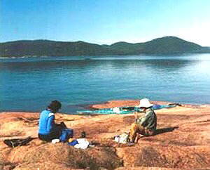
We had had a good first few days, a challenging crossing and we were due for some serious rest and relaxation. I had heard of the “Come and Rest” before, when I worked for Lake Superior Provincial Park. This little sanctuary on Superior was originally built by the Ministry of Natural Resources, serving as a base camp for those studying the Woodland Caribou. The buildings are now maintained by locals and anyone passing by who notices that attention is needed in a particular aspect. We were giddy with excitement as we landed just before noon, noticing that no one else had staked claims on the location for the upcoming night. It was ours! Our first view of the place was an antique wrought iron bathtub on the beach, somewhat tacky, but strategically placed over a fire pit! It was a hot tub! Next we sighted the main cabin, with a deck, followed by a second bunkhouse, which was soon established as the “girls club” cabin. We all voted to park it for the night and take it easy.
It was good that we landed when we did to stake our claim; another three parties followed throughout the afternoon and were disappointed to see the place was taken. Don and Donna’s group pulled up to the dock for a late lunch. It was like a secret GLSKA Rendezvous. The afternoon was filled with other interesting visitors. It was a great day and I decided to finish it off by baking pizza for everyone. Jim retreated to the “boy’s club” cabin to read. Sarka and I read the cabin log around our small campfire for as long as we could manage to keep our eyes open. I enjoyed reading entries from personal acquaintances such as fellow sea kayak guides, teaching counterparts and rangers from Lake Superior Provincial Park. It was home. One entry recounted a November crossing to the Slates, by sea kayak: “I never thought my handgrip was strong enough to shatter a paddle shaft. I was wrong… three-metre breaking waves on the crossing… I had to change my pants when I got here…” Skill and a humble attitude are required to paddle Lake Superior. The following morning I made an entry for our GLSKA group.
For the next two days, we toured the Slate Islands exploring at a fairly leisurely pace. Our campsites were second to none. We had complete exposure to the open lake, which kept the bugs away. The swimming was frigid and secluded. When we tired of swimming, we hiked up the cliffs to a caribou highway, often having to duck down below blown down trees to continue on these well-worn paths. Sarka continued her harvesting everything and anything found growing on the ground; I continued my climbing of rock walls. The entertainment was endless, the seas perfectly cooperative and the temperatures in the 20s. On one particularly clear day, we climbed a rock island at lunch, and, looking out in a southerly direction, identified Michipicoten Island, Point Au Canadien, Pic Island and Tip Top Mountain on the clear horizon.
While enjoying the Slate Islands, we paid close attention to a large cold front moving in from James Bay. Environment Canada was predicting that by Tuesday, the day we were scheduled to finish our trip, the front would be upon us, creating a big storm and a massive drop in temperatures. All was going well and not one of us was interested in paddling in the forecasted 11-degree temperature, thunderstorms and constant rain. This clearly spelled potential hypothermia in my books, and I did not want to deal with that at any cost. We decided to cross back to the mainland a half day earlier than planned, in half-metre following seas, wind not worth mentioning and 23-degree temperatures under clear skies. As we were departing, we experienced one of those magic moments. I was paddling silently alongside a rocky ledge of a small island near the Dealoute Islands when an adult bald eagle swooped down off the ledge so close that I could have easily touched it with my paddle; I could feel the wind from its wings. We departed content with all we had seen and done on the Slates.
Dave Tamblyn, of Superior Outfitters, had suggested we stop at the ghost coal-mining town of Jack Fish, due north of the Slates. We pulled up on shore and examined chunks of coal amongst the white sand beach. This was our first sand beach of the trip and we eagerly lay there dumbfounded, absorbing the heat of the sand after our crossing. A short hike back across the rail tracks, we explored the miners’ former residences. Farther on, we explored concrete foundations, remains of houses and former pastures, all caught in a time warp. Wildflowers were abundant in the open fields and the scent in the air was wonderful. We left the beach and paddled about six kilometres to the most bouldery and difficult to walk on campsite of the trip. We had made excellent progress, but were exhausted and needed to land and rest.
Our campsite looked west with an excellent view of the Slate Islands, Copper Island and the wide-open Lake Superior. I pitched my tent on a level section of the rocky beach while Sarka and Jim pitched theirs on the lichen covered raised cobble beach. Early that morning, Sarka had the privilege of seeing “the second best northern lights show of her life.” She also had pitched her tent less than twenty metres from a pair of ancient Pukaskwa Pits, which I found in the morning while attending to the call of nature. Sarka remarked, “We really do get everything on this trip!” We had seen Pic Island and it seemed, although no one stated it, that a goal of the trip was to experience this idyllic silhouette on the horizon. Today we would arrive at the destination and see if it captivated our minds as much as we anticipated.
The waters were again as calm as we could have asked for, hardly that expected on a Lake Superior trip. We paddled beneath a long three-kilometre section of the Steel Mountain, where there is no opportunity for a landing. It can be very rough at times and the tiny coves just beyond the mountain are a good rest stop. Upon passing by these coves, we were interrupted by three loons on the lake who appeared to be going absolutely loony! Honestly, the two larger ones constantly called to each other while doing odd jumps into the air and then hilarious nosedives. This continued constantly for nearly ten minutes and then Jim and Sarka figured the scenario out; mom and dad loon were encouraging and teaching baby loon to fly – somewhat unsuccessfully it seemed. It was comedy at its best though.
We arrived at a beautiful white sand beach dotted with drift wood trees at the Prairie River Mouth Provincial Nature Reserve. There are often numerous species of waterfowl in this river, but none were present today. Sad to say, the end of the trip was now in sight. Departing from the river we decided to take advantage of the glassy smooth waters and cross directly to Barclay Island. Part way across, Sarka and I noticed a rather square object floating not more than twenty feet from our kayaks. It was the head of an otter, a sight that we do not often have the privilege to see. It slipped beneath the surface of the water silently and resurfaced for a short time, but too far off to show up in a photo. I found it rather ironic that an otter should surface in the middle of the lake on our trip; the otter is a symbol in native culture as a guide to a safe crossing across large fjords.
We continued on from Barclay Island with the final crossing to our now monumentalized and cherished Pic Island. We met a solo kayaker from Minnesota sunning on the beach in Windy Bay. He paddled on soon after we landed. After setting up camp and pitching the tarp to scare the rain away, Jim retreated to his tent. I went looking for the old trail which used to be used by the park rangers for wildlife studies. The trail was identifiable in 1998 when I was here last but now was hardly distinguishable. Instead, Sarka and I decided to climb as high as we could up a rock face. We made it to the highest point and had views of the lake like nowhere else. Looking around, Sarka saw the first pines of the trip, a few dwarfed clusters of jack pines atop this great mountain of bare rock and immediately remarked, “This is a special place.”
After dinner, Sarka and I sat on the beach and watched the setting sun. Caribou are abundant on the Slates, but sightings are rare on the mainland. However, not more than ten minutes passed and a male caribou with a respectable rack wandered from the bush, along the slick rock shore and out to the point of the island. This was a picture-perfect moment.
The next morning, we circumnavigated the huge Pic Island with its rock cliffs, lush forests and giant sea caves. I had often passed by a set of smaller islands just south of Pic Island and we took this opportunity to explore them briefly. We noticed an odd object on a rocky shoal. It looked like a small walrus with tusks, but couldn’t be in this area. Sarka realized it was a second otter sighting and the tusks were fish that the otter was dining on. This one was far more friendly and playful than the last, but with breakfast in his jaws, he kept a very safe distance from us and eluded any decent photograph opportunity. We referred to this area and much of the paddle to the next campsite as “The Little Georgian Bay.” The rocks were so smooth, doubtless as a result of the powerful storms that Superior breeds in the fall time. We had lunch with one last clear view of Pic Island. There was a storm brewing ahead, and Pic Island would soon be lost in the storm clouds.
We camped on geological rock formations, similar to those of Georgian Bay, except all very red in colour. It was very barren, desolate and inspiring. I sat up and watched the pulp operations in the town of Marathon from my vestibule for some time that night. It was like a child’s perfectly set up model train set. I couldn’t smell any of the pollution, as my sinuses were as thick as glue by this point with the cold from the first night. I couldn’t help but compare this town to the former one of Jack Fish.
The next morning was humid – far too humid for six o’clock. Clouds had covered the formerly sunny, blue sky. Nothing was said, but we all knew we had to be quick about our activities. Environment Canada had issued a severe thunderstorm, waterspout and small craft warning, with waves of one metre building to two early in the morning. Wind and waves do not bother me. They become predictable to some degree and in my very distorted frame of mind, they are the comfortable norm for travelling. Electricity is another issue and I could smell it that morning. We were on the water by seven. The first rumble occurred and I pulled back up to shore. Sarka assured me the storm was still far off. My gut disagreed but I went along with her suggestion, “We’ll paddle then. The next available landing is about six kilometres away.”
Those next six kilometres contained constant rumbling, getting louder and closer – fast. Pic Island was now completely hidden by the steel blue pouring rain and approaching storm. There was an odd peach hue to the sky and the wind picked up slightly, but the waves more than doubled in size. As we passed between the mainland and an island, the now two-metre waves were crashing up the bare rocks. Riding the waves was fine and would have been considered fun if it weren’t for the thunder that was now occurring more frequently. On previous trips through this area, I had stopped below the leaching ponds of the paper mill for an emergency washroom break. This area, that I had formerly found to be a disgusting reflection of civilization, now became the tiny bit of comfort I was aiming to land on and set up shelter to wait for the storm to pass. Sarka was a good distance behind me, and Jim farther behind. A sandbar had formed roughly one hundred metres offshore from the sand beach we planned to land on. This effectively created a double surf zone for the landing. Fun on a sunny day, turned challenging today. I made it through the first zone and then the second and pulled my boat up fast. I turned to see where Sarka was and to help her. She was approaching the first zone and I turned away to tie my boat to a driftwood tree as the waves were pounding the stern with increasing strength and size. In the few seconds it took to turn away from Sarka and tie my boat, Sarka had capsized in the first zone and was now floating next to her swamped kayak, drifting towards a rocky outcrop. I waded out to help and redirect her boat. It took the two of us to pull it up onto shore and she immediately set to work pitching her tent. Jim’s turn was next, some hundred metres down the beach. I ran down to assist him. He jumped out of his boat fast, grabbed the bow and I grabbed the stern, pulling it up out of the reach of the lake. Quickly informing him of what had happened, we ran back to Sarka to help empty the water from her completely swamped kayak.
Jim and I pitched the tarp as quickly as possible and sat under it as we watched the storm pass. We had landed in the nick of time; lightning started not more than fifteen minutes after we landed and the rain lasted, intermittently, all day long. Sarka was fine; a little annoyed I’m sure with me checking on her in her tent every twenty minutes, but I didn’t want to see her suffer hypothermia and this was the perfect day for it. Eventually she emerged and joined us under the tarp. The rain and thunder stopped by eleven in the morning, but the waves crashing on shore were still a daunting two metres. Relaunching today was simply not an option. We had paddled well for the entire trip, been gifted with stellar weather, become overconfident in our decision to try to beat the storm and were simply frustrated that we could make little more than six kilometres today. But that is how Lake Superior works. You go when you can and sit in awe and amazement when you can’t. I can name at least a dozen friends who were stuck in southern Ontario offices that day, and would have given anything to see the show we had front row seats to beneath the tarp. We had had enough water for one day.
I heard the waves stop about four the next morning. It was raining but we could launch and push on to Hattie’s Cove. According to Environment Canada, the temperature was the dreaded 11 degrees predicted. We departed at seven in the rain, with fifteen-knot tail winds and one-metre waves. Sarka and Jim elected to wear wetsuits; I chose not to, as the water was warmer than the air. We kept a steady pace, and with the tail winds arrived in Pukaskwa at about nine in the morning. We loaded our gear into the cars in near silence as quickly as possible, ran for the hot showers and put on the last of our dry clothes. The temperature had dropped to seven degrees, according to the local radio station, and we were glad to be done the trip.
As the organizer of the trip, I’m glad that we experienced a Superior storm. We now have a real understanding of what can happen on the lake, which we would never have gained if we’d had sunny skies and 24-degree weather the whole time. Thanks for a great time: 215 kilometres, four bald eagle sightings, two river otter sightings, four caribou sightings, two Pukaskwa Pits and countless walls to climb. Now it’s time to plan next summer’s Superior trips.